

Garmin Garmin Montana 710, EMEA, TopoActive

Specifications
Information
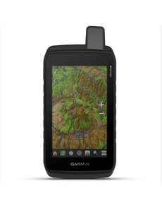
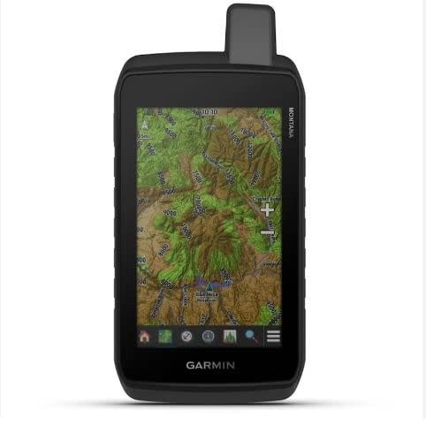
STAY ON TRACK THROUGH ALL KINDS OF ADVENTURES
With routable mapping for roads and trails, the Montana® 710 handheld brings advanced outdoor features into a sturdy 5-inch format that’s ideal for navigation on foot, bike, kayak, ATV and more. This durable, water-resistant handheld is tested to meet MIL-STD 810 for thermal, shock, water and vibration. It features a glove-friendly 5-inch touchscreen and is compatible with a variety of robust mounting solutions (sold separately) to best suit your activities. To navigate your adventures, use preloaded topographical maps. View terrain contours, elevations, coastlines, rivers, landmarks and more. Access subscription-free, high-resolution satellite imagery with direct-to-device downloads over Wi-Fi® connectivity. See photorealistic overhead views of routes and surrounding terrain, and easily create waypoints based on landmarks.
General
- Lens material Chemically strengthened glass
- Dimension 8.76 x 18.30 x 3.27 cm (3.5″ x 7.2″ x 1.3″)
- Weight 410g (14.5oz) with included lithium-ion battery pack
- Water rating IPX7
- MIL-STD-810 Yes (thermal, shock, water, vibe)
- Touchscreen
- Display Type WVGA transflective, dual orientation
- Display Size 6.48 x 10.80 cm (2.55″W x 4.25″H); 12.70 cm (5″ diag)
- Display Resolution 480 x 800 pixels
- Battery type Rechargeable lithium-ion (included)
- Battery life GPS Mode: up to 24 hours
- Expedition Mode: up to 440 hours
- Powered Off: up to 1 year
- Note – Battery life estimates are with full sky view and can be significantly impacted by obstructions or tree cover.
- Memory/history 32 GB (user space varies based on included mapping)
- Interface USB-C


